Spring is on the way, which means that we’re thinking about lacing up our hiking boots + hitting the trails. Lucky for us, there are a lot of them here, and one of the most famous – the 2,190-mile Appalachian Trail, or AT – runs right through our backyard.
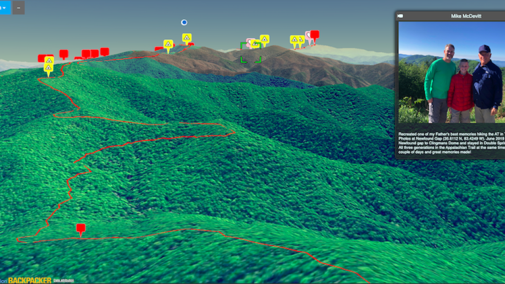
And, whether you’re a thru-hiker, section hiker, or just like to dip in for the day, we think you’ll be as thrilled as we were to find this new interactive 3D map of the AT from Backpacker.com.
The map, which is best viewed on a desktop or tablet rather than a cell phone, includes images of the trail + surrounding forest, towns, and parks, plus hikers’ favorite spots. Bonus: You can add your own highlights + stories here.
While you’re getting your gear together, here are a few fast facts about the AT –
- It’s the longest hiker-only trail in the world.
- Three million people visit the AT annually.
- About 20,000 people have hiked the entire trail, which runs from Springer Mountain in Georgia to Katahdin in Maine.
- Hiking the full trail takes an average of five to seven months.
- It crosses 14 states total and has a 464,500’ elevation gain/loss.
- In our area, the trail runs right through the town of Hot Springs.
- For every four hikers that start the trail, only one finishes.
- Most thru-hikers start at the Southern terminus of the trail in early spring + walk north.
Protip: While interactive + virtual maps are great for planning and research, the Appalachian Trail Conservancy advises using comprehensive printed maps on the trail.
Here are a few cool things we discovered while exploring the map –
Hiker tips organized by state, like this one that points readers to Winding Stair Gap + Franklin, NC – which includes a tip about where to get a pancake breakfast.
Hike highlights, which include info + photo galleries on notable trail sections + stops – like Great Smoky Mountains National Park, known to hikers for its plant life + bears. DYK: 71 miles of the trail run through the park – including the AT’s highest point?
Reader submissions, coded with pink heart icons, share stories from the trail, like this one from Clingmans Dome.


